Posts

Showing posts from January, 2024

Before it was Wallace, Montana, it was called Baker's Station

Image
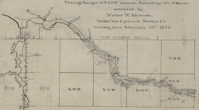
The oft-repeated history of Clinton, Montana claims it was established in 1883 as a stage stop and post office on the Mullan Road and was initially known as Betters’ Station, named after my great-great-grandfather, Austin Betters. The reality is that Col. J.C. Baker had established a stage station on the Mullan Road in the vicinity of present-day Clinton at least 13 years earlier. Not only that, but the stage stop that became known as Baker's Station was much closer to the Wallace Mining District and the eventual locations of the railway stations for the NPRR and Milwaukee Road than the Betters homestead was. Baker's Station, the Stage Station The earliest mention I have found of Baker's Station in any printed documentation was in the January 20, 1872 edition of The Pioneer , which referred to Col. Baker as "the proprietor of Baker's station on the Deer Lodge road," but it's likely he established his stage station a few years before that. In the 1870 Censu

Pineland, Montana

Image
In  this 1883 map of the Montana Territory from the Department of the Interior, General Land Office , Pineland is the only city or town between Missoula and Bears Mouth (now called Bearmouth) on the Mullan Road. As a point of reference, Stony Creek is what's known as Rock Creek today. From the November 23, 1882 edition of the Helena Weekly Herald : A new post-office has recently been established some miles below, which is very appropriately called Pine Land. A fine two story public house has been erected, which will be of great convenience to the traveling public. The proprietor, Mr. L. W. Frank, has had much experience as a landlord, and is well adapted for the business. The Pineland post office only existed from July 28, 1882 to April 2, 1883. In the Western Territories in the 1880s, getting the Post Office Department to approve a new post office was easy (Probably too easy) but the Pineland post office made some sense, being halfway between existing post offices in Missoula and

Northern Pacific Railroad Spur Track in Wallace, Montana

Image
I wasn't planning on posting today, but I accidentally happened upon a May 1903 USGS topographic map of Clinton tonight, so I decided to take a closer look at it and see if I could see the spur track mentioned in the Mickelsen papers . Lo and behold, the map shows one! The track wasn't very long at all (See blue arrow below). It definitely didn't reach the mining camps -- It didn't even reach Wallace Creek -- but there must have been enough activity from mining and logging that it was needed. The map, which is based on surveys from 1900, also shows the Betters/McQuarrie home (See green arrow). There are lots of other fun things to see on the full map, which you can access yourself at the USGS website .

Origins of Names of Stations and Townsites from Northern Pacific Railway Corporate Records

Image
I haven't yet been able to return to the Mansfield Library in Missoula, but a helpful employee in Archives and Special Collections saved me a trip. She took a look through the Northern Pacific Railway Company records I mentioned in a previous post and reported that she did not find any references to Wallace, Blossburg, Clinton, or McQuarrie within. She referred me to the Minnesota Historical Society (MNHS), which was next on my list anyway. MNHS will digitize records in their collection upon request for a small fee, so last month I ordered the scan of two folders listed in their finding aid as "Origins of names of stations and townsites." My order was delivered digitally today and I am going to share with you what I found. First, an attribution: Most of the pages appear to be part of a typewritten document titled: Northern Pacific Railway The Origin and Historic Significance of the Names of Towns and Stations Located on the Lines of the Railway A Record Compiled by John