Posts

Showing posts from 2023

Tough, Willing, and Able: Tales of a Montana Family

Image
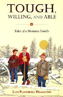
I visited the Lewis and Clark Library in Helena earlier this month. While there, I decided to see if they had anything in their collection that would be useful for my research. They did! The book, Tough, Willing, and Able by Lois Flansburg Haaglund "tells the story of the Flansburgs, a logging family in Clinton, Montana, whose combined courage sustains them through the hardships of the Great Depression and beyond." Not only did the library have this book in its collection, it was in circulation and it was on the shelf, so I checked it out. I'm pretty sure I had heard about this book before, but even when I had a copy of it in my hands at the Lewis & Clark Library, I didn't fully understand its potential relevance to my family history research. The Flansburg name was familiar to me, though, and since the book was about a logging family in Clinton, I figured it was worth a read, in case there was some useful information in it. I realized later why the Flansburg name

I-90 Through Clinton

Image
I came across this August 17, 1964 photo of the then-newly-constructed interstate highway near Clinton at the Montana History Portal . I have been hoping to find construction photos of the interstate where it passes through the Betters homestead, but this is the closest I have come. This is west-northwest of Clinton, where the interstate crosses over the railroad. The view is looking west-northwest (towards Missoula). I have labeled notable landmarks. One thing I haven't yet delved into in my research is the McQuarrie siding. If you have driven past Clinton on the interstate, you may have seen sign(s) for it. I have included a photo I took in 2013 below. At first, I thought McQuarrie had been a station on the NPRR, but it's too close to Clinton for that to make any sense. Dan McQuarrie was heavily involved in logging, so my current theory is that the siding was where he loaded his logs onto railcars. Ironically, there is an old rock quarry in the vicinity. I don't know when

Origin of the Montana Place Name Wallace

Image
In  Don Bert Omundson's 1961 thesis "Study of place names in Missoula County, Montana,"  his entry for Wallace simply said, "(See Clinton)." However, he did include an entry for Wallace Creek: T12N Rl7W. Empties into the Clark Fork River from the e. near Clinton. Named for Lieutenant Wallace who captured some warring Blackfeet Indians there in 1878. (L. Custer Keim) Previous Names: Camas Trail Creek. This name existed as late as 1886, the year in which water rights were taken out on this stream. At that time this name was in concurrent usage with the name which later succeeded it, Wallace Creek. (Forest Swartz) Omundson's source, Lawrence Custer Keim, misidentified the tribe but correctly identified the origin of the place name Wallace. And he should know. His father, Frank M. Keim, was one of the three men who founded the Wallace Mining District. It looks like Omundson was well on his way to finding the truth. His thesis included a three-page supplement/app

What Happened to the Pine Grove House on the Betters Homestead?

Image
Once I knew where the Betters homestead was and that I-90 passed right through the property, I was fairly certain that the "fine two story public house" built in 1882 had been demolished or moved to make way for the interstate highway. I emailed the historian and archaeologist at the Montana Department of Transportation a few times over the years to see if they had any ideas about what might have happened to the house, but that effort didn't go anywhere. Finally, this year, after digging through route plans and right-of-way documents I found online, I realized that much of the right of way for I-90 was carved out of the very wide Northern Pacific Railroad (NPRR) right of way, and in that part of the canyon, I-90 was on the other side of the tracks from where I believed the Pine Grove House stood. That's when the Chicago, Milwaukee, & St. Paul Railroad (CM&StP) became my primary suspect. The CM&StP (also known as the Milwaukee Road), constructed between 190

The Death of Jane Betters

Image
One of the first things I found over a decade ago when I started searching through old newspapers for any mentions of the Betters in Montana was an account of the horrible accident that claimed my great-great-grandmother's life in 1899. I had intended to write about it in this blog but never did. I don't know why, but every time I tried to blog about it I ended up writing about something else. I'm now in a place where I need  to share the story. Over the past couple of weeks, I have made several exciting discoveries that are worthy of sharing, but I can't share those stories unless you are aware of the events that led up to them, and Jane's death set all those other things in motion. First, a warning: The descriptions of Jane's fatal injuries in the first news clipping are more graphic than we are used to seeing in today's news media. Here is how the accident was reported in th e August 26, 1899 issue of the Missoula Daily Democrat-Messenger: The account of

A Place-Name Fact-Check for Clinton, Montana

Image
I sometimes lose track of what I've blogged about and what I had intended to blog about but didn't. So, in case I haven't mentioned it before, I suspect that Don Bert Omundson's 1961 thesis "Study of place names in Missoula County, Montana"  is the source of all later references to Betters' Station and some other historical facts about Clinton, Montana and its previous names. I have reached a point in my research where I can now do a fact-check on most of the information Omundson included about Clinton in his thesis. To try to keep this manageable for me and hopefully easier for you, my reader, to follow, I am going to take this paragraph by paragraph. First Paragraph Clinton T12N R17W. Small community 15 miles e. of Missoula on the N.P.R.R. and C.M. & St.P. Named in November, 1889, after Henry Clinton. It is undecided whether Clinton was a railroad man or a lumberman. (Mrs. Nettle, Albert Partoll) The date appears to be correct. An article in the Nove

Even in the 1930s, Clinton-Area Residents Were Confused About the Origin of Their Town’s Names

Image
I came across this article from the January 7, 1932 issue of The Missoulian today and thought it was worthy of a quick share: So, as to the origin of the name "Clinton," W.C. Peat, who was then secretary of the Missoula Chamber of Commerce, believed that Clinton was named after a surveyor on the crew that laid out the Northern Pacific Railroad. W.H. Beacom, who was Missoula's mayor at the time this article was written, recalled that Clinton was named after C.L. Clinton, an official of the Northern Pacific Railroad. Is a surveyor an official? Were Peat and Beacom in alignment, or are these two different NPRR employees named Clinton? F.G. Bond and Andrew Logan both provide a logical reason for why the town's name was changed from Wallace that aligns with my long-held belief, which is that there was confusion with Wallace, Idaho, another small, mining town 135 miles west on the route of the NPRR. Why Wallace, Idaho was able to keep its name when the Wallace Mining Distr

Betters Homestead / Pine Grove House in Pineland Grove

Image
As I noted in a post from 2015 , Don Bert Omundson's 1961 thesis "Study of place names in Missoula County, Montana"  was a real breakthrough for my Clinton/Betters research. His thesis included some supplementary pages, labeled "Miscellaneous information from Missoula Courthouse records about some of the places and men mentioned in the following thesis." In those pages was information about property acquired by Austin Betters in 1883. In 2017, I traveled to the Missoula County Record Center and found the deed referenced by Omundson. That deed has since been digitized and is now available online at the Missoula County Clerk & Treasurer's website (See below). The quitclaim deed is dated April 19, 1883, and transfers the property from L.W. Frank to Charles L. Harris and Astin [sic] Betters for $400. Here is the description of the property: said land is situated about 2 miles south of Wallace Mining District, on the road leading from Missoula to Bears Mouth

Ekstrom Stage Station

Image
The Ekstrom Stage Station  is a restaurant and campground alongside Rock Creek, about a mile south of I-90 at exit 126. The property features "a collection of reconstructed western Montana homesteader cabins and frontier buildings moved log by log from their original location up and down the Clark Fork Valley." Due to the proximity of Ekstrom Stage Station to the Betters homestead, I had hoped that one of the buildings had been moved from the Betters property. I don't know where the smaller cabins were moved from, so that remains a possibility, but the main building, a former stage station, was not the Pine Grove House. It was the Birmingham Flats Station building which was originally located along the Mullan Road in Bearmouth, 15 miles east of Rock Creek. The photos below are from my visit to Ekstrom's on July 16, 2017.  

Facts about how the Betters came to Montana

Image
A draft of this post has been sitting, mostly complete, since November 2013. Today, I finally put the finishing touches on it and published it. Hopefully, this will spur me to resume sharing the results of sporadic research I have conducted on the Betters in Clinton over the past decade. Ernest Terry and Fannie Nettle aren't in my direct line, but this is one of those cases where I learned about my ancestors through tangential research. Guy Howlett lived next to Fan and Ern when he was growing up, so he was able to tell me quite a few stories about them. After meeting with Guy in Clinton, I decided to do some research on Ernest and Fannie, which turned up this article in the June 2, 1969 issue of the  North Pacific Union Gleaner about Fannie's 99th birthday : The article provided me with a number of gems: Fannie "came to Montana with her family, including her great-grandmother" - This was a completely new revelation to me. While I don't have a name, and I don